


TRV l'olan-Le clos xavier blanc AS

Surfou
User

Length
13.1 km

Max alt
2349 m

Uphill gradient
407 m
Km-Effort
22 km

Min alt
1091 m

Downhill gradient
1334 m
Boucle
No
Creation date :
2022-07-24 08:56:26.941
Updated on :
2022-07-24 08:56:26.941
4h54
Difficulty : Very difficult

FREE GPS app for hiking
 SityTrail
IGN / Geographical institutes
SityTrail Plus
The world is yours!
About
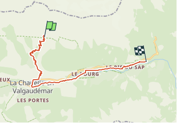
Trail Walking of 13.1 km to be discovered at Provence-Alpes-Côte d'Azur, Hautes-Alpes, La Chapelle-en-Valgaudémar. This trail is proposed by Surfou.
Positioning
Country:
France
Region :
Provence-Alpes-Côte d'Azur
Department/Province :
Hautes-Alpes
Municipality :
La Chapelle-en-Valgaudémar
Location:
Unknown
Start:(Dec)
Start:(UTM)
279056 ; 4969139 (32T) N.
Comments